Portfolio
Geospatial
Tree canopy was one of the criteria used in a mosquito vector sampling site selection analysis (data analysis done in ArcGIS). The Google Earth plugin is required to view this map. The plugin can be downloaded for free here. Or click here to view the complete project in the stand-alone Google Earth viewer.
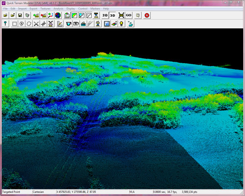
LiDAR point cloud visualized in QT Modeler. Digital Elevation Models (DEMs), Digital Surface Models (DSMs), and Normalized Digital Surface Models (nDSMs) were derived from this data set and used to aid in the land cover classification below.

Detail of land cover classification prepared in Definiens eCognition.